June 18, 2010 -- As one of, if not the most, well preserved and remote cliff dwellings in the Southwest, visiting Keet Seel was the culmination of many of my ambitions this past year.
The site is located 8.5 miles from the Navajo National Monument Visitor Center and can only be accessed after obtaining a back country hiking permit and by appointment. It was awesome to complete the 17 mile hike in a day with my dad. We were the only ones on the trail that day and literally had the entire canyon to ourselves.
We arrived at National Monument at 9:00PM the night before and set camp in the great camping facilities adjacent to the visitor center.
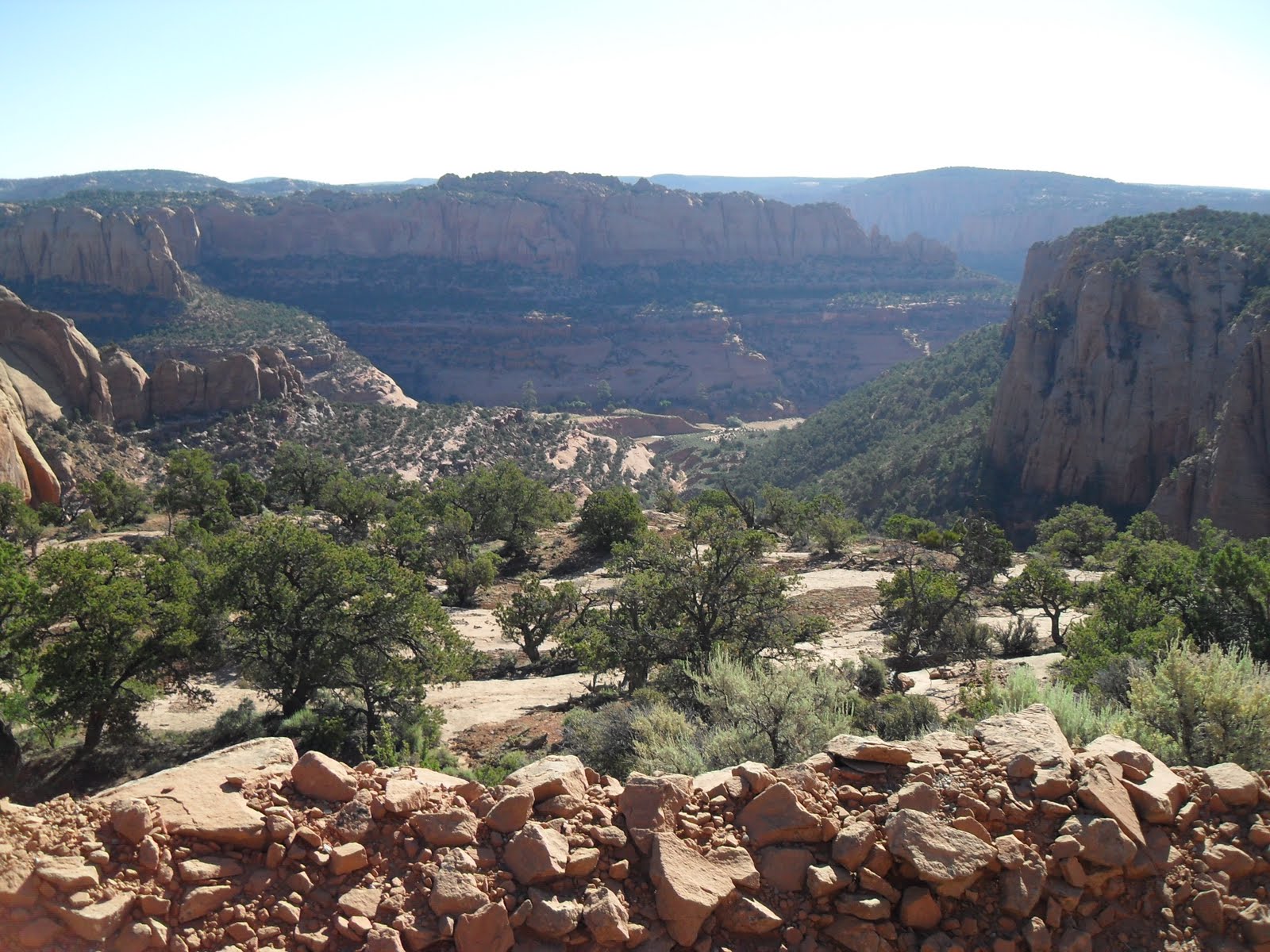
At 8:00 AM sharp we were being introduced to the terrain we would be traversing in the required orientation. The ranger gave a presentation about what we should expect to encounter, e.g. quicksand, 1000 foot vertical decent, roaming cattle, snakes, etc... We were able to hit the trail by 8:30 AM and soon found ourselves at Tsegi Canyon Overlook which gave commanding views of the entire region.
Then the trail quickly drops 1000 feet from the canyon rim to the canyon floor on rocky then sandy switchbacks which we knew we would hate to climb at the end of the day.
Once on the canyon floor the trail is marked by white posts approximately every one half to one mile along the route and although incredibly beautiful the region is indeed very remote.
We found ourselves hiking along, then across, then through the shallow stream that leads to the alcove of Keet Seel. For nearly 6+ miles we navigated the waters. At first we tried to keep our feet wet but by mile 4 we were between bare foot and soaking tennis shoes.
Upon arrival at Keet Seel we met Max our Ranger guide who lives for periods at a time in a small cabin outside the ruin. He gave us time to snarf down some trail mix and water and then led us through the incredible cliff dwelling. Since we were the only visitors for the past two days, Max was very talkative and engaging and was more than gracious in answering endless questions.
According to wikipedia, "Kiet Siel (commonly spelled Keet Seel), stands for "broken pottery" in Navajo. The site was first occupied around AD 1250, during a time in which a large number of people were believed to be aggregating in sites such as this in this part of the American Southwest. There was a construction boom at Kiet Siel between AD 1272 and 1275, with construction then slowly tapering off and halting completely at AD 1286. Once construction halted in AD 1286, there was no evidence of structures being built until its subsequent abandonment some 20 years later. At its peak, its believed that up to 150 people inhabited this site at one time."
There are all sorts of beautiful and iconic artifacts indicative of ancestral puebloan culture at Keet Seel, such as jacal walls, symbolic petroglyphs, pottery, kivas, T-shaped doorways, etc...
We spent nearly two hours simply exploring the site and discussing theories.
Finally, having filled our minds with images view get to experience we said goodbye to our Navajo guide and began our return 8.5 mile trip. We decided to walk most of the return bare foot or in our Vibram Five Fingers only to put back on our shoes back on before the final ascent.
We reached my Montero at about 6PM and quickly made our way to Kayenta for Burger King and Gatorade. It was a long day in the hot sun but our epic hiking adventure will forever be remembered as Father and son wandered the back country in a remote corner of the Navajo Nation to see a site few have experienced. Admittedly, boy are we sore!
Showing posts with label Cliff Dwellings. Show all posts
Friday, June 18, 2010
Friday, February 19, 2010
Gila Cliff Dwellings, New Mexico
By now it's certainly stating the obvious when I say I love exploring cliff dwellings. From the remote and solitary dwelling in Cedar Mesa, to the archaeological tourist mecca of Mesa Verde there is just something about antiquity high in forgotten alcoves.
When I was in college I attempted to make it to the Gila Cliff Dwellings National Monument but ran out of both gas and daylight. Finally after 11 years and with a wife and two kids in tow I made it to the impressive site in Southwest New Mexico.
Our adventure to Gila Cliff Dwellings began as just one adventure in a weekend spent with friends at their cabin in the Mimbres. Waking up early we headed on the scenic SR35 and connected with SR15 which has incredible vistas and ascends and then descends considerable elevation.
Arriving at the National Monument we learned that the main road bridge to the trailhead had been washed out and we would need to park at "Woody's Corral" and hike in. Ten feet from our cars a marked trail invited us.
Traversing the sandy trail which followed the Mimbres river we were encouraged and optimistic about the afternoon ahead, and the kids (five under five years old) were just as excited.
After about a mile we found ourselves on the south riverbank with nothing but a few footprints, some kairns marking the faint path and tired kids. Surely we didn't miss the trail?
Bushwhacking the next 200 yards we then caught sight of the bridge at the trail-head which spans the river- hope alas. The kids were troopers and we forged ahead. Approximately 75yards from the bridge (and an obviously manicured trail) we face a daunting obstacle. The riverbank disappeared and we would need to scale a steep incline, shimming ourselves and five little ones across an extremely difficult embankment without dumping ourselves into the frigged river.
For nearly 40 minutes we struggled to cross what had become an increasingly dangerous spot. To far to turn back and not far enough to be comfortable. Mind you there were a couple of casual hikers who spotted us from the bridge just a couple of yards away but never offered help. Luckily, thanks to divine providence and tenacity we made it across. Tired, weary and still white with nerves we stopped for lunch at the real trailhead.
As we finished lunch I approached an irritated NPS volunteer who stood as a sentinel for the hike. She asked me where our group was from, (obviously having watched our approach for the last 40 minutes). After I answered, she began to lecture me about the importance of following the marked trails in a National Monument. I could not believe her audacity! Frustrated beyond belief, I chided that we had in fact been following the marked trail which started less than ten feet from our cars and then I asked if she really thought it was my intention to drag five kids through the willows and endanger them! Seriously, get-a-clue! Don't give me crap for trying to following your lame make-shift trail, fording a cold river while you watch and then berate my orienteering skills while you collect your $2.00 an hour for providing a lame rehearsed diatribe about the meaning of the monument. (Wow, can you tell I'm still a little impassioned?)
Okay, so the rest of the trip was fantastic. After lunch the kids had some renewed energy and so did we and we headed up the trail. The one-mile loop trail to and through the site ascends nearly 180 feet high above the canyon floor and the views are awesome.
The dwellings which were built by the Mogollon peoples are surely impressive and remote. It is estimated that the dwelling was built between 1276 and 1287 but by 1300 the Glia Cliff Dwellers had moved on. Such a mystery to their purposes in the high alcoves, and signs of hostility and violence are supposedly lacking.
According to the NPS brochure, approximately 40 rooms were built inside several natural caves in Cliff Dweller Canyon. The inhabitants built T-shaped doorways and left behind macaw feathers from Central America.
After exploring the caves and dwellings we returned to our cards following the road, what a huge difference pavement makes. On a personal note, Gila Cliff Dwellings were phenomenal and I would have loved to have had the opportunity to spend more time there! But a word of caution for the next traveler- trails are not well marked from Woody's Corral to the ruins unless you intuitively believe that a road is a trail and a marked trail head is just a ruse!
When I was in college I attempted to make it to the Gila Cliff Dwellings National Monument but ran out of both gas and daylight. Finally after 11 years and with a wife and two kids in tow I made it to the impressive site in Southwest New Mexico.
Our adventure to Gila Cliff Dwellings began as just one adventure in a weekend spent with friends at their cabin in the Mimbres. Waking up early we headed on the scenic SR35 and connected with SR15 which has incredible vistas and ascends and then descends considerable elevation.
Arriving at the National Monument we learned that the main road bridge to the trailhead had been washed out and we would need to park at "Woody's Corral" and hike in. Ten feet from our cars a marked trail invited us.
Traversing the sandy trail which followed the Mimbres river we were encouraged and optimistic about the afternoon ahead, and the kids (five under five years old) were just as excited.
After about a mile we found ourselves on the south riverbank with nothing but a few footprints, some kairns marking the faint path and tired kids. Surely we didn't miss the trail?
Bushwhacking the next 200 yards we then caught sight of the bridge at the trail-head which spans the river- hope alas. The kids were troopers and we forged ahead. Approximately 75yards from the bridge (and an obviously manicured trail) we face a daunting obstacle. The riverbank disappeared and we would need to scale a steep incline, shimming ourselves and five little ones across an extremely difficult embankment without dumping ourselves into the frigged river.
For nearly 40 minutes we struggled to cross what had become an increasingly dangerous spot. To far to turn back and not far enough to be comfortable. Mind you there were a couple of casual hikers who spotted us from the bridge just a couple of yards away but never offered help. Luckily, thanks to divine providence and tenacity we made it across. Tired, weary and still white with nerves we stopped for lunch at the real trailhead.
As we finished lunch I approached an irritated NPS volunteer who stood as a sentinel for the hike. She asked me where our group was from, (obviously having watched our approach for the last 40 minutes). After I answered, she began to lecture me about the importance of following the marked trails in a National Monument. I could not believe her audacity! Frustrated beyond belief, I chided that we had in fact been following the marked trail which started less than ten feet from our cars and then I asked if she really thought it was my intention to drag five kids through the willows and endanger them! Seriously, get-a-clue! Don't give me crap for trying to following your lame make-shift trail, fording a cold river while you watch and then berate my orienteering skills while you collect your $2.00 an hour for providing a lame rehearsed diatribe about the meaning of the monument. (Wow, can you tell I'm still a little impassioned?)
Okay, so the rest of the trip was fantastic. After lunch the kids had some renewed energy and so did we and we headed up the trail. The one-mile loop trail to and through the site ascends nearly 180 feet high above the canyon floor and the views are awesome.
The dwellings which were built by the Mogollon peoples are surely impressive and remote. It is estimated that the dwelling was built between 1276 and 1287 but by 1300 the Glia Cliff Dwellers had moved on. Such a mystery to their purposes in the high alcoves, and signs of hostility and violence are supposedly lacking.
According to the NPS brochure, approximately 40 rooms were built inside several natural caves in Cliff Dweller Canyon. The inhabitants built T-shaped doorways and left behind macaw feathers from Central America.
After exploring the caves and dwellings we returned to our cards following the road, what a huge difference pavement makes. On a personal note, Gila Cliff Dwellings were phenomenal and I would have loved to have had the opportunity to spend more time there! But a word of caution for the next traveler- trails are not well marked from Woody's Corral to the ruins unless you intuitively believe that a road is a trail and a marked trail head is just a ruse!
Monday, November 23, 2009
Montezuma's Castle and Montezuma Well
November 23, 2009--- 50 miles south of Flagstaff, Arizona just off I-17 remains evidence of an imposing castle like cliff dwelling perched nearly 100 ft off the valley floor. Today Montezuma Castle National Monument is home to interpretive trails, a small visitor center and gawking tourists but anciently Southern Sinagua famrers began building a five-story, 20-room dwelling as early as the 1100's.
I reached the park an hour before sunset and because of it's easy access and well groomed interpretive trail I made great time exploring Montezuma Castle. Visitors can no longer climb and access the actual dwelling, however, the monument has undergone extensive restoration to remain picturesque.
As impressive as the castle is, my true ambition on this trip was to see Montezuma Well. Nearly five miles up the canyon from Montezuma's Castle a limestone sink formed by the collapse of an immense underground cavern. With a spring flowing into the sink Southern Sinagua farmers irrigated and harnessed the water.
Overlooking the well various dwellings stand watch over the beautiful waters.
Montezuma Well is a lush oasis which provides a stark contrast to the arid desert surrounding the area. It is of little wonder why the ancients would find such a place home.
For more information on Montezuma's Castle and Montezuma Well visit the National Parks site.
I reached the park an hour before sunset and because of it's easy access and well groomed interpretive trail I made great time exploring Montezuma Castle. Visitors can no longer climb and access the actual dwelling, however, the monument has undergone extensive restoration to remain picturesque.
As impressive as the castle is, my true ambition on this trip was to see Montezuma Well. Nearly five miles up the canyon from Montezuma's Castle a limestone sink formed by the collapse of an immense underground cavern. With a spring flowing into the sink Southern Sinagua farmers irrigated and harnessed the water.
Overlooking the well various dwellings stand watch over the beautiful waters.
Montezuma Well is a lush oasis which provides a stark contrast to the arid desert surrounding the area. It is of little wonder why the ancients would find such a place home.
For more information on Montezuma's Castle and Montezuma Well visit the National Parks site.
Subscribe to:
Posts (Atom)